


Floods
Floods are one of the leading causes of death from natural disasters in the United States.
Over 200 flood-related fatalities are reported each year with over half being vehicle-related when people try to drive through floodwaters. Floods can damage and devastate homes and farms, displace families as well as pets and livestock, damage crops, and disrupt agriculture processing and business.
Flood situations are variable and can occur as a result of spring snowmelt, severe thunderstorms, prolonged rains, inadequate drainage or failure of levees and dams. The impact can be local affecting a neighborhood or community, or very large, affecting entire river basins and multiple states. Some develop slowly – allowing time to prepare and evacuate – while others (e.g., flash floods) can develop quickly, even within minutes.
While flood situations cannot be entirely prevented, steps can be taken to prevent or minimize injury and loss and speed the recovery process. The following resources will help you prepare your family, home and farm, animals and business for flood situations.
Flood Preparedness Factsheets
|
• Floods and Your Family [PDF] • More Family Resources |
|
|
• Floods and Your Home [PDF] • More Home Resources |
|
|
• Floods and Your Pets [PDF] • Floods and Your Livestock [PDF] • More Pet and Livestock Resources |
|
|
• Floods and Your Farm [PDF] • More Farm Resources |
|
|
• Floods and Your Crops [PDF] • More Crop Resources |
|
|
• Floods and Your Business [PDF] • More Business Resources |
Know the Terminology
Flood Watch: Conditions are favorable for flooding. Be Prepared!
Flood Warning: Flooding is imminent or already happening. Take Action!
Flash Flood Watch: Conditions are favorable for flash flooding - typically within 6-48 hours. Be Prepared!
Flash Flood Warning: Flash flooding is imminent or occurring. Move immediately to high ground. Take Action!
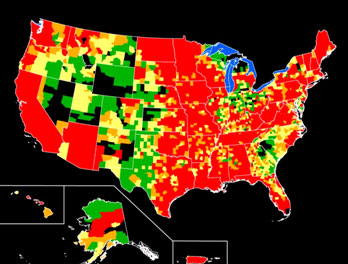
Determine the risk of flooding in your area.
Click on a state to learn more about the types of flooding that has occurred there.
National Weather Service
Map showing current flood or high flow conditions in the United States.
U.S. Geological Survey
Learn about Floods and Their Impact
Information explaining the concept and uncertainties of the "100-year" flood.
U.S. Geological Survey (USGS)
CDC's main website of flood preparedness, response and recovery information.
Centers for Disease Control and Prevention (CDC)
Website with FEMA flood maps - find flood maps for your area or address.
Federal Emergency Management Agency (FEMA)
Factsheet describing the impact of floods and USGS monitoring efforts.
U.S. Geological Survey (USGS)
NDSU-Extension flood preparedness and recovery website - contains factsheets, weblinks, podcasts and more.
North Dakota State University Extension Service
Website discussing the differences in flood watches and warnings issued by the National Weather Service.
National Weather Service
Website listing Kansas Department of Agriculture Floodplain Management newsletters.
Kansas Department of Agriculture
Guide explaining floods, with suggestions for preparing for a flood situation.
National Weather Service (NOAA NWS)
Document discussing the largest floods that have occurred within the United States.
U.S. Geological Survey (USGS)
Monitor river conditions in your area for flood watches and warnings.
National Oceanic and Atmospheric Administration (NOAA)
Main website of the USGS on flood related resources, including mapping of flood and high flow water conditions in the United States.
U.S. Geological Survey (USGS)